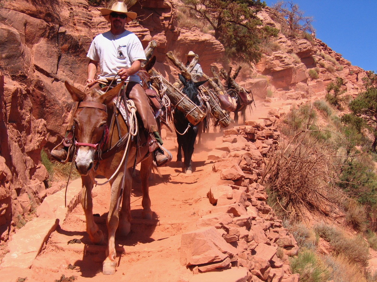
Named the Colorado river because of the reddish-brown sediment load it often carries, this river’s path through the Grand Canyon is one of the world’s most exciting and technically challenging river experiences.
Credit: Paul Hirt
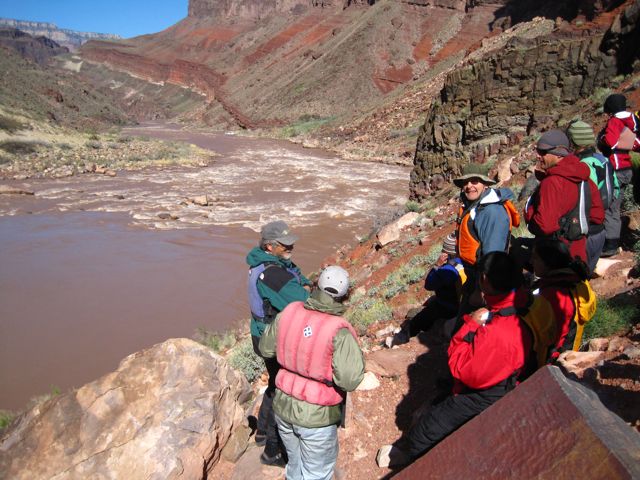
The muddy and turbulent Colorado River through the Grand Canyon is known as one of the best whitewater runs in the world. Like a well conducted symphony, its crescendos and diminuendos are its rapids and pools. The river tests human emotions for weeks at a time as guides and passengers work their way towards the climax, Lava Falls. The story of this rapid has become legendary, and its location in the downstream reach of the Grand Canyon makes it a memorable culmination to a river trip. River guides love to tell stories about this rocky torrent that river guides have rated Class 10—the highest degree of difficulty. All week long they field questions from anxious passengers about what to expect. When do we get to Lava? How big was that rapid compared to Lava Falls? And sometimes, can we walk around Lava? Yes, Lava Falls is one of the scariest ten seconds on the river, for passengers and boatmen alike, but without it a river trip through the Grand Canyon would not be the same.
Historically Lava Falls has always been a big rapid, even Major John Wesley Powell and Robert Brewster Stanton refused to attempt it. They feared for their safety and lined and portaged around it. The first successful run of Lava came twenty-seven years after Powell skirted the rapid. George Flavell and Ramon Montez (spellings vary), started their expedition during late August of 1896 and ran all the rapids of the Grand Canyon except one, Soap Creek. Flavell published his journal of that trip, in which he said, “There is only one stone we must not hit, our Tomb Stone!” Sounds like sheer luck carried them through. Like most rapids in Grand Canyon, Lava Falls has changed a lot since the days of Flavell and Montez; unlike Flavell and Montez, not all river runners have fared so well.
When Major Powell viewed the rapid in 1896 it actually started 85 meters downstream from where it starts today. The head of his rapid formed a line perpendicular to the flow of the river, and a prominent tongue of water entered the left side. The only feature boatmen today might recognize from 100 years ago is the Black Rock, or Camel Rock, at the lower right-hand shore of the rapid. But why is it different and what other changes have occurred?
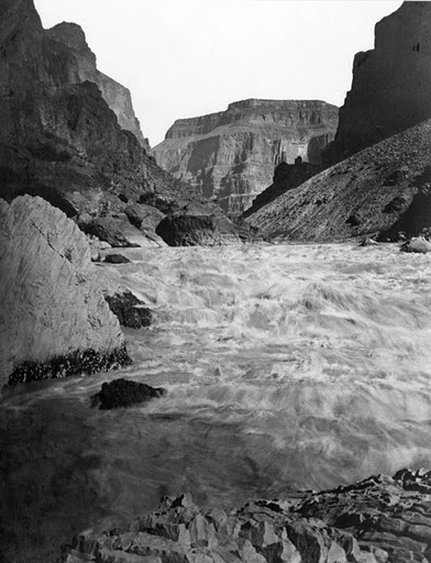
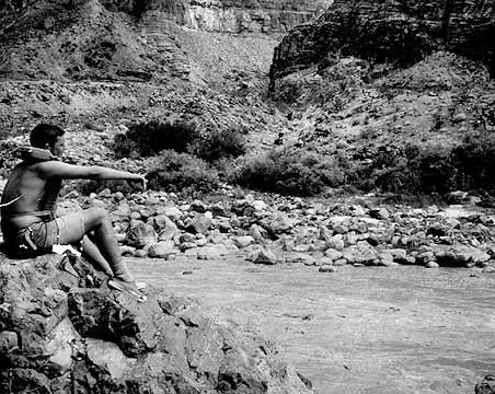
John Hillers, a member of Major Powell’s second Colorado River expedition, captured this photo in 1872 from the foot of Lava Falls along the right shore.
Credit: NAU Cline Library, Call No: NAU.PH.1999.80.515
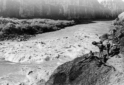
Photo from the right shore at the head of Lava Falls rapid in 1894. Note the Black Rock jutting into the current for a comparison with the Hillers photograph above.
Credit: NAU Cline Library, Call No: NAU.PH.97.46.16.75
The best way to answer this question is to explain why Lava Falls exists in the first place. All rapids have at least three main causes, a constricted river channel, which increases the velocity of the current, an uneven river bed, which increases turbulence, and an elevation drop from one end to the other, which enhances both speed and turbulence. These three factors combine to form rapids. For virtually all of the rapids in Grand Canyon this constriction and unevenness comes from debris fans deposited in the river from side canyons. At river mile 179 Prospect Canyon enters on the south side of the river. At the foot of its debris fan sits Lava Falls.
The Grand Canyon is a perfect setting for these debris fans. Debris flows are what create them, and these flows primarily occur in arid to semiarid environments. They are usually initiated after a heavy rainfall on steep slopes of ten degrees or more. A debris flow is different than a mud flow or a flash flood because it consists of a highly-concentrated poorly-sorted mixture of rubble, sediment, and water that behaves differently than most fluid flows. In other words, this fluid has the ability to carry and deposit boulders the size of automobiles.
Prospect Canyon provides an optimum environment for this to occur. It has the second largest debris fan in Grand Canyon, behind Kwagunt Creek. It has six measured historic debris flows, and one of those debris flows is the largest in Grand Canyon’s recorded human history. River runner Georgie White actually witnessed one of these historic debris flows during a river trip in 1955. Some of Lava’s more notable and dangerous features, the Ledge Hole and the V-Waves, formed during a 1957 flood. When Major Powell came through the canyon the debris fan constricted the river by only three percent. Today the river is constricted around fifty percent! (Griffiths, 8)
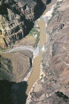
Note how the debris fan of prospect canyon constricts the river into a narrower channel.
Credit: NAU Cline Library, Call No. NAU.PH.97.46.195.20
A 1963 photo of Lava Falls at low water.
Credit: NAU Cline Library, Call No. NAU.PH.96.4.57.23
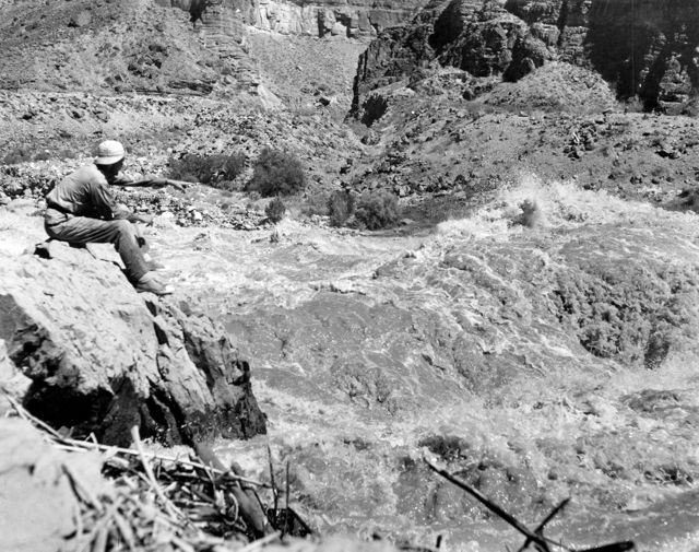
This photo is at the same location thirteen years earlier and at a different river flow level. Notice the change in the rapid with fluctuating water levels.
Credit: Grand Canyon Archives
The Major might have feared for his safety, but he had a knack for naming physiographic features, and Lava Falls was no exception. What many people do not realize is that the western Grand Canyon lies on the edge of the Uinkaret Volcanic Field. During the Late Cenozoic, molten rock made its way up a giant fault system in the region called the Toroweap, and now the landscape above the canyon is peppered with cinder cones and lava flows. The most famous cone is named Vulcan’s Throne, and it sits on the North Rim directly above Lava Falls. This mile-wide cone formed from material that came up the Toroweap Fault. Lava flowed into the Grand Canyon all the way down to the Colorado River creating a lava dam five- to six-hundred feet high. The resulting lake backed water up to Lees Ferry! Over time the river eroded the lava dam draining the lake but leaving visible remains of the lava flow on both sides of the river. Seeing these volcanic remnants Major Powell noted, “What a conflict of water and fire there must have been here! Just imagine a river of molten rock running down into a river of melted snow. What a seething and boiling of the waters; what clouds of steam rolled into the heavens!” Although some people refer to the rapid as Vulcan, Lava Falls is the name most used today.

Vulcan’s Throne viewed from the south. See the hardened cascades of lava against the canyon walls.
Credit: NAU Cline Library, Call No. NAU.PH.97.46.16.18
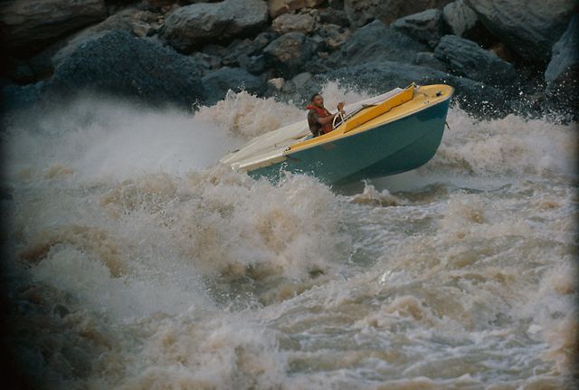
Jon Hamilton steers the “Wee Yellow” up Lava Falls rapid during the 1960 upriver run.
Credit: Courtesy NAU Cline Library, Call No: NAU.PH.97.46.16.75
Most river guides have one or two interesting tales about how they ran Lava Falls, but only one tells a story about how he took a boat up the rapid. River guides in Grand Canyon love to be the first to do anything, first to run a rapid, first to climb some obscure rock pinnacle, but for Otis “Dock” Marston and his 1960 expedition, it was an uprun of the Colorado River through the Grand Canyon. Many early river runners like Harry Aleson and Ed Hudson vainly attempted this feat in the 1950s, but their thundering propeller-driven boats did not have enough power to make it up some of the rapids in Grand Canyon. The eventual success of the trip depended on the invention of the jet boat by New Zealander Bill Hamilton and his son Jon Hamilton.
The company Indiana Gear Works acquired the American manufacturing rights to the new “Turbocraft.” The Grand Canyon uprun proved an excellent test for the equipment and publicity stunt for the company, plus they footed the expensive bill. Dock Marston spearheaded the effort as chief navigator and Bill Austin as chief pilot. The expedition ran down the river first to cache the necessary fuel for the uprun. At Lava Falls Austin took the down run too fast and his boat went airborne off a head wave. A jarring landing in the middle of the rapid broke Austin’s femur! The following morning rescue arrived from Luke Air Force Base in Phoenix, and took him to the south rim for a waiting DC-3 to Las Vegas for medical treatment.
The expedition continued for the rest of the crew. After stashing the requisite supplies on the downriver run, they began their historic upriver run. They knew that Lava Falls was the only rapid truly standing between them and a successful run up the Colorado River through Grand Canyon.

Vulcan’s Anvil is an ancient volcanic remnant that sits mid-river approximately one mile upstream from Lava Falls. It is a sacred site to the Hualapai Indian Tribe, and many river guides have rituals they will perform here to ensure a safe run in Lava Falls.
Credit: NAU Cline Library, Call No: NAU.PH.2004.8.2.53b.3
After many failed attempts, New Zealander Jon Hamilton managed to coerce all four boats up the throat of Vulcan. The expedition finally succeeded. The high cost, inefficiency, and subsequent National Park regulations against motorized runs upriver ensure that this “first” will likely be the last time such a feat is accomplished.
At the end of a long week or two on the river and a successful run through Lava Falls, many boats pull into the “Below Lower Lava Beach” campsite, not coincidentally also known as “Tequila Beach.” Here passengers and boatmen reflect on their experiences, and tell tales of past adventures. It is here that the legends of Lava Falls begin.
Written By Mark Buchanan
References:
- Abacus, C.V. “Dock’s Data of Navigational Numbers: The First 100 Grand Canyon River Runners,” boatman’s quarterly review 22, no. 3 (Fall 2009): 23.
- Boggs Jr., Sam. Principles of Sedimentology and Stratigraphy. 4th ed. Upper Saddle River, New Jersey: Pearson Prentice Hall, 2006.
- Collins, Robert, and Roderick Nash. The Big Drops: Ten Legendary Rapids. San Francisco, Ca: Sierra Club Books, 1978.
- Griffiths, Peter and Bob Webb. “The Changing Rapids of Grand Canyon: Lava Falls Rapid,” boatman’s quarterly review 14, no. 1 (Spring 2000): 8-10.
- Lavender, David. River Runners of the Grand Canyon. Tucson, Arizona: University of Arizona Press, 1985.
- Martin, T. and Whitis, D. Guide to the Colorado River in the Grand Canyon: Lees Ferry to South Cove. Fourth Edition. Flagstaff, Arizona: Vishnu Temple Press, 2008.
- Powell, John Wesley. The Exploration of the Colorado River and its Canyon. New York: Dover Publications, 1961.
- Smith, Philip M. “Jon Hamilton,” boatman’s quarterly review 23, no. 1 (Spring 2010): 24-46.