Many hikers camp in informal locations on the Esplanade. Choose a bedrock site to limit soil disturbance, and carry sufficient water from the rim to ensure arrival at Thunder Springs the next day.
Photos: National Park Service.
So wrote Grand Canyon National Park Superintendent Harold Bryant in the early 1950s, responding to a tourist’s inquiry on what recreational opportunities lay below the North Rim west of the Kaibab Plateau. The honest response probably embarrassed Bryant, who had been the park’s superintendent since the late 1930s, a man who knew his park, or thought he did. No one seemed to know the specific origin of the springs or the river it produced, or how a “river” (the shortest in the world at less than one mile in length) could flow into a “creek” (Tapeats Creek).
The Thunder River Trail emerged from long centuries of intensive Native-American use. Occupation in the trail vicinity dates to the middle period of Virgin Ancestral Puebloans, if not the late Archaic period, with the most intensive early use occurring between A.D. 1075-1150. Following an occupational hiatus of perhaps 150 years, Southern Numic peoples migrating from the Great Basin began to hunt and gather animals and plants as early as 1300, perhaps a bit earlier.
The Kaibab band of Southern Paiutes ranged from Kanab Creek east to the Paria River after this date until the early twentieth century. The Paiutes’ subsistence strategy of living in the uplands in the summer and the lowlands in the winter, similar to that of prehistoric puebloan peoples, suggests that they adopted puebloan travel routes into the Thunder River area. If Bryant had thought to ask the Paiutes around Pipe Springs and Kanab, he would have learned much about Thunder River.
European American settlers entered the region in the 1850s, when Mormon trailblazer Jacob Hamblin first crossed the Arizona Strip from southwestern Utah on his way to the Hopi pueblos. Hamblin did not approach the North Rim above Thunder River until 1870, but his explorations led Dr. James Whitmore to establish a cattle ranch at Pipe Springs in 1863. The Black Hawk War among Mormons, Utes, Paiutes, and Navajos of 1866-1869 arrested further Mormon development until 1870.
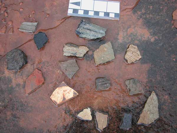
Thunder River’s long cultural history has left many artifacts and archeological sites behind. Collecting artifacts in piles limits their informational value to archeologists, and touching rock art leaves skin oils that will cause images to fade.
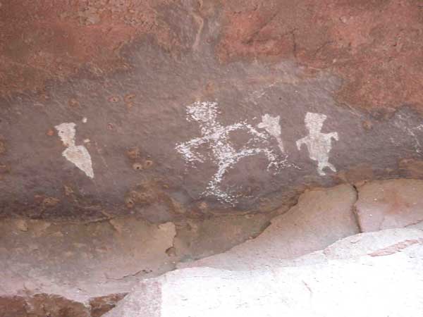
Thunder River’s human occupation dates to the middle period of Virgin Ancestral Puebloans, if not the late Archaic period, with the most intensive early use occurring between A.D. 1075-1150.Petroglyphs such as these should be left undisturbed.
After that year, four events opened the area to permanent European-American exploration and exploitation: Mormon resettlement at Kanab in 1870, John Wesley Powell’s use of Kanab Creek for his second river trip in 1871-1872, which would lead to a nearby “gold rush” in the latter year, USGS geologist Clarence Dutton’s mapping of the area in 1880, and settlement at Fredonia (1885).
Prospectors of the early 1870s likely tested the Thunder River area for minerals, but Mormon cattlemen were the first to take economic advantage of the Esplanade immediately above Thunder Springs. In 1870 church president Brigham Young and others organized the Canaan Cooperative Stock Company to graze church cattle upon the Arizona Strip near Whitmore’s failed cattle ranch. In 1871 Mormon bishop Levi Stewart and his son John established a sawmill and ranch at Big Springs, less than fifteen miles northeast of the later Thunder River Trailhead.
The United Order of Orderville ran both cattle and sheep over the same range in the 1870s, and others quickly joined these early cattlemen to exploit what at the time were abundant bunch grasses throughout the Arizona Strip.
Cattle operations continued to play a major role in Thunder River Trail history into the 1960s, but by the early 1920s, Arizona Strip residents were awakening to the economic opportunities afforded by tourism. In 1923 a road connecting Ryan Ranger Station near Fredonia to the “Grand Canyon Highway” (today’s Highway 67) at DeMotte Park was completed, directing traffic within twenty miles of the Thunder River Trailhead (today’s Forest Road 22). The Kane County Standard reported on May 23, 1923, that
“Major Goldman arrived in Kanab last week with 10,000 trout fry to be placed in Thunder River Canyon wont [sic] it be great to hop into Thunder river and get a fry for breakfast. If they live they will grow to be an enormous size.”
So began the legend of “monster trout” awaiting fishermen at Thunder River and Tapeats Creek.
U.S. Forest Service ranger Ed Laws visited Thunder Springs in 1924, and returned the following year with others to build a formal trail from the rim to Surprise Valley. Laws went to work for the National Park Service thereafter, and in 1931, visited again with fellow park rangers J.P Brooks and Art Brown and forest rangers Walter G. Mann and Robert H. Parks to check on the trout population, and in 1940 to restock the river soon after the final segment of the trail from the rim of Surprise Valley down to Thunder Springs and Tapeats Creek was completed in 1939.
Aside from cattlemen and a few government rangers, hunters had also begun to visit the North Rim at the turn of the century, initially to harvest large herds of mule deer, and after 1906, to hunt mountain lions with the Forest Service game warden, Uncle Jim Owens. After the Forest Service again opened the area to deer hunting in the 1920s, large numbers began to visit immediately above the Thunder River Trail. Local entrepreneur Hayden Church and his wife built three hunting camps within the Kaibab National Forest at Big Saddle, Moquitch Canyon, and Pine Flat soon after 1923. Mardean Frost Church and husband Jack (Hayden’s son), and their son Steve, continued to operate these camps until the 1960s when unrestricted hunting within the forest and the loss of their Forest Service concession forced camp closures.
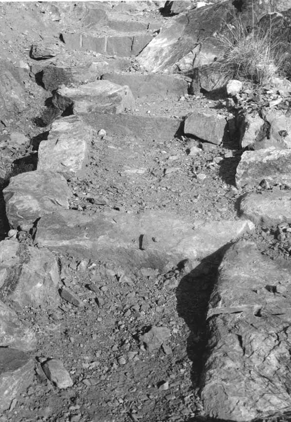
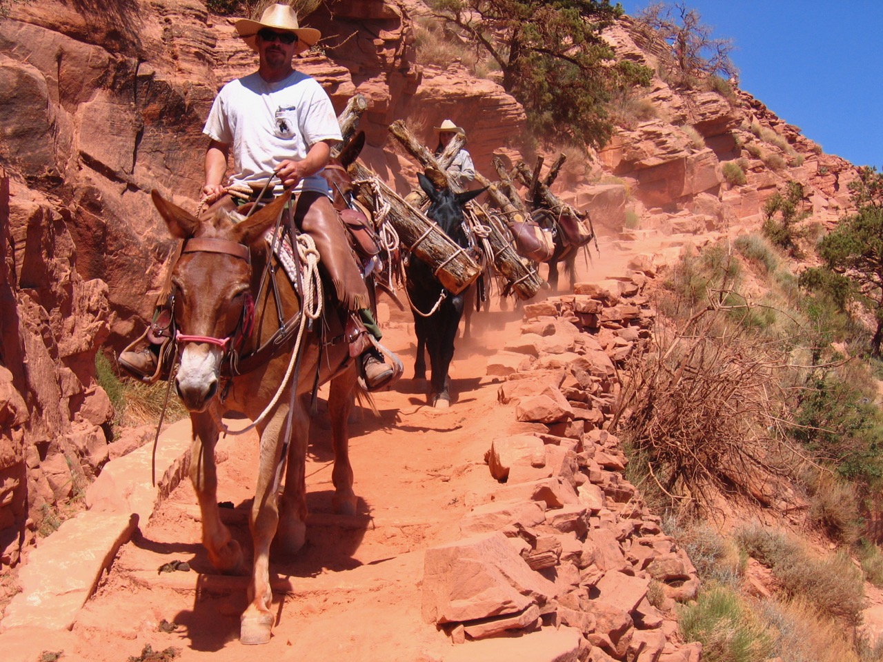
Variable routes, paths, and trails have been used by prehistoric peoples, prospectors, explorers, cattlemen, hunters, and tourists for millennia. U.S. Forest Service ranger Ed Laws built this set of steps in 1925, while later hunting guides and cattlemen maintained them.
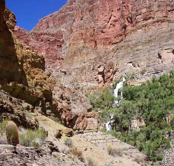
Thunder Springs gushes from the Muav Limestone below the Redwall, forming the smallest river on earth. It joins Tapeats Creek less than a mile below. Camping is not allowed anywhere along Thunder River to protect the riparian environment.
Although hunting was restricted to the forest above the rim, Mardean Church recalls that each year a few hunters prolonged their stay with a fishing trip to Thunder River. Some of the hunting guides, including Ron Mace, Wallapai Johnnie Nelson, Steve Church, Billy Swapp, and Tuffy Swapp, would double as fishing guides and lead perhaps four annual autumn and spring visits to Camp Cove (today’s Upper Tapeats Campground) at the confluence of Thunder River and Tapeats Creek. This was often done in conjunction with the movement of horses and mules to and from the Esplanade for winter pasturage. Mardean emphasizes that leading fishing trips was secondary to her hunting operation and that the trips were neither advertised nor encouraged. A trip to Thunder River from Big Saddle was hard on mules and horses, and the animals were none too happy to descend the noisy, narrow drainage of Thunder River.
Although early efforts to stimulate tourism along the Thunder River Trail failed, the attention led to construction of the trail as far as Tapeats Creek by 1939. By the 1960s, river runners had begun to hike up Tapeats Creek as far as Thunder River, wearing an informal trail along the creek that joined with the formal trail at Camp Cove. Later river runners developed the popular loop hike up Tapeats Creek and Thunder River, across Surprise Valley, and back down Deer Creek to the river.
In the 1970s, the Park Service’s trail crew realigned an old route down from Monument Point on the rim as a shortcut to reach the Thunder River Trail on the Esplanade (today’s Bill Hall Trail), and in the 1980s it began to maintain the Tapeats Creek and Deer Creek segments of the trail. Also by the 1980s, the trail had become so popular among backpackers that the Park Service began to limit overnight use to preserve some semblance of a wilderness experience. Harold Bryant would be surprised how much change occurred in just 30 years!
Today, hopeful backpackers apply for a permit to Thunder River months before they plan to hike. Most choose to take the steeper Bill Hall Trail shortcut that gives them a better chance to reach Upper Tapeats Campground in one day. Others take the original trailhead at Indian Hollow, a gentler approach, and dry camp along the Esplanade before completing their journey to Tapeats the following day. Day hikes from the campground down Tapeats Creek to the river, and over Surprise Valley and down Deer Creek to the falls at the river are popular excursions. And yes, you can fish for the “monster trout” in Tapeats Creek and Thunder River, although as one old cowboy guide used to say, you might need chains to reel them in.
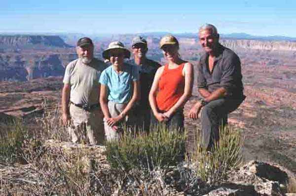
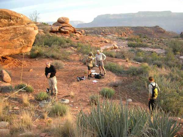
The trailhead at Indian Hollow. Today’s hikers enjoy distant and intimate views of the intricate Esplanade as well as the lush riparian habitat along Thunder River and Tapeats Creek. It is one of the best hikes in Grand Canyon.
Written By Michael F. Anderson
References:
- Anderson, Michael F. Living at the Edge: Explorers, Exploiters and Settlers of the Grand Canyon Region. Grand Canyon Association, 1998.
- Anderson, Michael F. Polishing the Jewel: An Administrative History of Grand Canyon National Park. Grand Canyon Association, 2000.
- There are at least a dozen published Grand Canyon Trails guides that include Thunder River, many of which can be purchased through the Grand Canyon Association website.