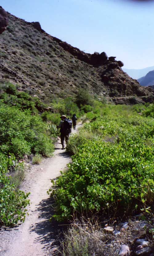
Hikers make their way down the North Kaibab Trail.
Photo: Patricia Biggs
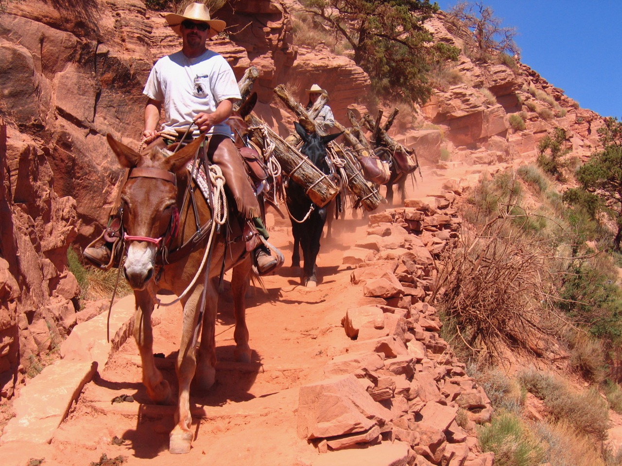
Once the National Park Service had constructed the South Kaibab Trail in the mid 1920s as an alternative to Ralph Cameron’s privately controlled Bright Angel Trail, they decided to ensure their control over this portion of the Grand Canyon by constructing a trail that would link the South and North Rims. As the Fred Harvey Company developed Phantom Ranch, the NPS realized that it would draw more tourists, and they assumed that this would lead to an increased demand for a route to travel up Bright Angel Creek to the North Rim. Since they were encouraging development at Bright Angel Point on the North Rim, they believed that a new trans-canyon trail would advance these goals and increase hiker access to the canyon. Upon its completion in 1928, the North Kaibab Trail connected to the South Kaibab to create the only NPS-maintained trans-canyon rim-to-rim trail, as well as the only maintained trail into the Canyon from the North Rim. Combined, the North and South Kaibab Trails extend slightly over 20.5 miles.
Beginning on the North Rim in a forest of fir, spruce, and ponderosa pine, the North Kaibab Trail winds through Bright Angel Canyon on its way to Phantom Ranch at the bottom of the canyon. While Native Americans likely had footpaths that descended into the canyon here, the earliest known Euro-Americans to travel down into the Grand Canyon via Bright Angel Canyon were hunting guides and cattlemen.
The precursor to today’s trail was pioneered by Francois Matthes and his party of geologists and cartographers when in 1902 he was sent by the US Geological Survey to plot sections of the North Rim of the Grand Canyon. The group had started their work on the South Rim, crossing the River using the South Bass and North Bass Trails because at that time it was the nearest crossing point with a ferry even though it was almost 25 miles away. When it came time to return to the South Rim, the party thought that it would be easier to try to descend along the Bright Angel Fault. They succeeded in clearing a rough path down to the river, which they crossed in a prospector’s wooden boat. They then ascended to the South Rim via the Bright Angel Trail.
Starting in 1906, David Rust, the first tourism operator on the North Rim, improved the route slightly as a way for his employer, the Grand Canyon Transportation Company, to send stock and tourists down into the canyon. To cross the Colorado, travelers used a cable car that Rust had built, or when floods destroyed it they were ferried across in a canvas boat. Though trans-canyon travelers, tourists, prospectors, and hunters used the trail, it remained hazardous and was not well-maintained, so it is not clear how much of this trail overlapped with the present-day North Kaibab Trail.
National Park Service trail crews started building the modern trail in 1920-1921. Unlike earlier efforts, the NPS worked on the trail from the bottom up. In these years, trail crews improved the lower portion of the trail, known as the Box, in a narrow portion of Bright Angel Canyon above Phantom Ranch. This eliminated about 40 of the more than 90 creek crossings that the earlier trails had made.
David Rust constructed this tramway spanning 450 feet across the Colorado River near the mouth of Bright Angel Creek.
Photo: NAU.PH.568.9399. Kolb Bros. Collection. Cline Library, Northern Arizona University

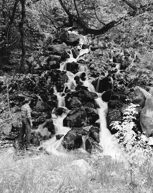
Beautiful Ribbon Falls is reached by taking a side trail about halfway down the North Kaibab Trail.
Photo: NAU.PH.2004.8.2.38d.2. Margaret Eiseman Collection. Cline Library, Northern Arizona University.
By 1926, NPS crews had constructed the trail from the bottom of the canyon up nearly to Ribbon Falls, at roughly the halfway point of the trail. In the cool months of 1926-28 crews worked to finish the trail from Ribbon Falls to its head on the North Rim at Bright Angel Point. The NPS continued to work on the trail, especially to reduce the number of times the trail crossed Bright Angel Creek, over the next few years. As the main transportation route connecting the South and North rims through Phantom Ranch, this trail system had to support heavy human and mule traffic. Crews built the trail to standards established when it constructed the South Kaibab Trail with low grades and a tread width averaging four to five feet. It was not a typical rough wilderness path like its forerunners.
Starting at Bright Angel Point on the North Rim, the modern North Kaibab Trail winds its way to Coconino Overlook, a rest area at the top of the Coconino Sandstone formation. The trail proceeds steeply downward through the Coconino into Hermit Shale on the south side of Roaring Springs Canyon to another rest area at Supai Tunnel, with water piped in from Roaring Springs below. To create this tunnel, NPS crews had to blast the path from solid rock using dynamite, portable drills, and jackhammers, employing techniques they had learned from constructing the South Kaibab Trail.
When they were finished, they had carved a 20-foot-long tunnel passing through the Supai Formation and Redwall Limestone. The tunnel leads to a series of switchbacks, supported by retaining walls, that lead through the four layers of the Supai Group. Hikers here can see some of the original stacked stone walls the NPS used to construct the trail. Beyond this, the trail reaches a long bridge, constructed after a 1966 flood, where the Supai Group meets the Redwall Limestone.
The trail is level along the upper part of the Redwall Limestone here before it drops through sections that have been blasted to supplement a natural break in the rock. The trail then follows along the base of the Redwall to reach the Muav Limestone and Bright Angel Shale. At the base of this section, about 4.5 miles from the trailhead, is a spur trail leading to Roaring Springs and the pump house.
Most of the equipment the NPS trail crews used was packed in by mules until 1927, when the Union Pacific Railroad installed a cable tramway from the North Rim to Roaring Springs. The railroad used these springs to supply their operations at Bright Angel Point on the North Rim by installing a water pipeline and powerful pump there.
The North Kaibab Trail continues to descend in a series of steep switchbacks as it heads through Roaring Springs Canyon. It reaches the pump house operator’s residence, then crosses a bridge over Manzanita Creek. From here it follows the creek to Cottonwood Camp, which consists of a ranger cabin, piped water, campsites, and other structures. After passing through camp, the trail heads across several hills before passing the junction of a side trail that leads to Ribbon Falls, about 6 miles above Phantom Ranch, at the mouth of Manzanita Creek.
Roaring Springs, a major feature of the North Kaibab Trail, also serves as the water source for the North Rim. Water is pumped up through pipes and stored on the rim.
Photo: NAU.PH.2003.11.4.2.B3058. Josef Muench Collection. Cline Library, Northern Arizona University.
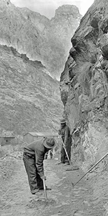
Civilian Conservation Corps workers help maintain the North Kaibab Trail.
Photo: Grand Canyon Archives, GRCA #277w2
The trail follows the east side of the creek and enters the “Box,” a narrow stretch of Bright Angel Canyon, crossing Bright Angel Creek several times using footbridges. Here, it seems that the walls of Bright Angel Canyon begin to close in as the rocks turn to the deeply incised dark gray Vishnu Schist. In this section flooding has damaged the trail several times. Today it features cemented stone walls, drainage structures, and metal bridges to try to reduce the destruction that these floods can cause. Along this route are retaining walls that were constructed when a trans-canyon pipeline and electrical lines were laid from Roaring Springs to the South Rim in 1967-70.
After crossing the river four times, and intersecting with the Clear Creek Trail, the North Kaibab Trail passes through the center of Phantom Ranch. David Rust had established a primitive tourist camp at this site at the dawn of the 20th century, but eventually the Fred Harvey Company took over the site and constructed buildings there in the 1920s. On the south side of the ranch, the trail continues past the Bright Angel Site, a stabilized prehistoric Native American ruin. It follows cliffs along Bright Angel Creek to reach the northern end of the Kaibab Suspension Bridge, sometimes known as the Black Bridge, that spans the Colorado River. From here hikers can reach the South Rim by taking either the Bright Angel or South Kaibab Trails.
Although the trail was completed in 1928, frequent maintenance has been required through the years. Major threats to the trail include extreme rainfall and spring thaws that produce flash floods and landslides. Until 1933, the NPS employed one full-time and several seasonal workers to maintain the trail. The full time employee oversaw the lower segment of the trail as well as the lower portion of the South Kaibab, while the seasonal employees worked from the Box to the North Rim. For the rest of the 1930s, Civilian Conservation Corps Company 818 was put to work on the trail clearing rockslides, repairing erosion damage, and doing other trail maintenance.
The upper portion of the trail is closed annually from mid-October through most of May because the higher elevation of the North Rim produces heavy snows that force it to be shut down over the winter months. In December 1966, heavy rains fell on winter snow pack, which led to a flash flood along Bright Angel Creek that destroyed the lower portion of the trail, along with several bridges and other structures, and severely damaged upper portions of the trail. When the trail was reconstructed, crews replaced wooden bridges with aluminum bridges and concrete foundations. The upper trail did not open again until 1969, and the bottom portion remained closed until summer 1971. The trail has seen many other damaging events since then, usually caused by heavy rains and flooding, though the NPS keeps it well maintained.
In 1981 Secretary of the Interior James Watt designated the North Kaibab Trail (along with the South Kaibab, Bright Angel, and Colorado River Trails) as part of the National Trails System because of their significant role in transportation and tourism at the Grand Canyon.
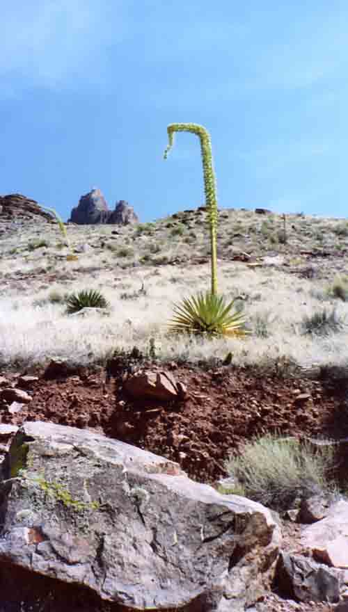
The North Kaibab Trail descends through several climatic zones, beginning with pine forest, hitting the Tonto Platform where desert plants and grasses grow, before dropping again into the inner gorge.
Photo: Patricia Biggs
Written By Sarah Bohl Gerke
References:
- Anderson, Michael. Polishing the Jewel: An Administrative History of Grand Canyon National Park. GCA, 2000.
- Anderson, Michael, ed. A Gathering of Grand Canyon Historians. Proceedings of the Inaugural Grand Canyon History Symposium, January 2002. GCA, 2005.
- “North Kaibab Trail.” Grand Canyon National Park. 2008.
- Shields, Kenneth Jr. The Grand Canyon: Native People and Early Visitors. Charleston, SC: Arcadia Publishing, 2000.
- Stampoulos, Linda L. Visiting the Grand Canyon: Views of Early Tourism. Charleston, SC: Arcadia Publishing, 2004.