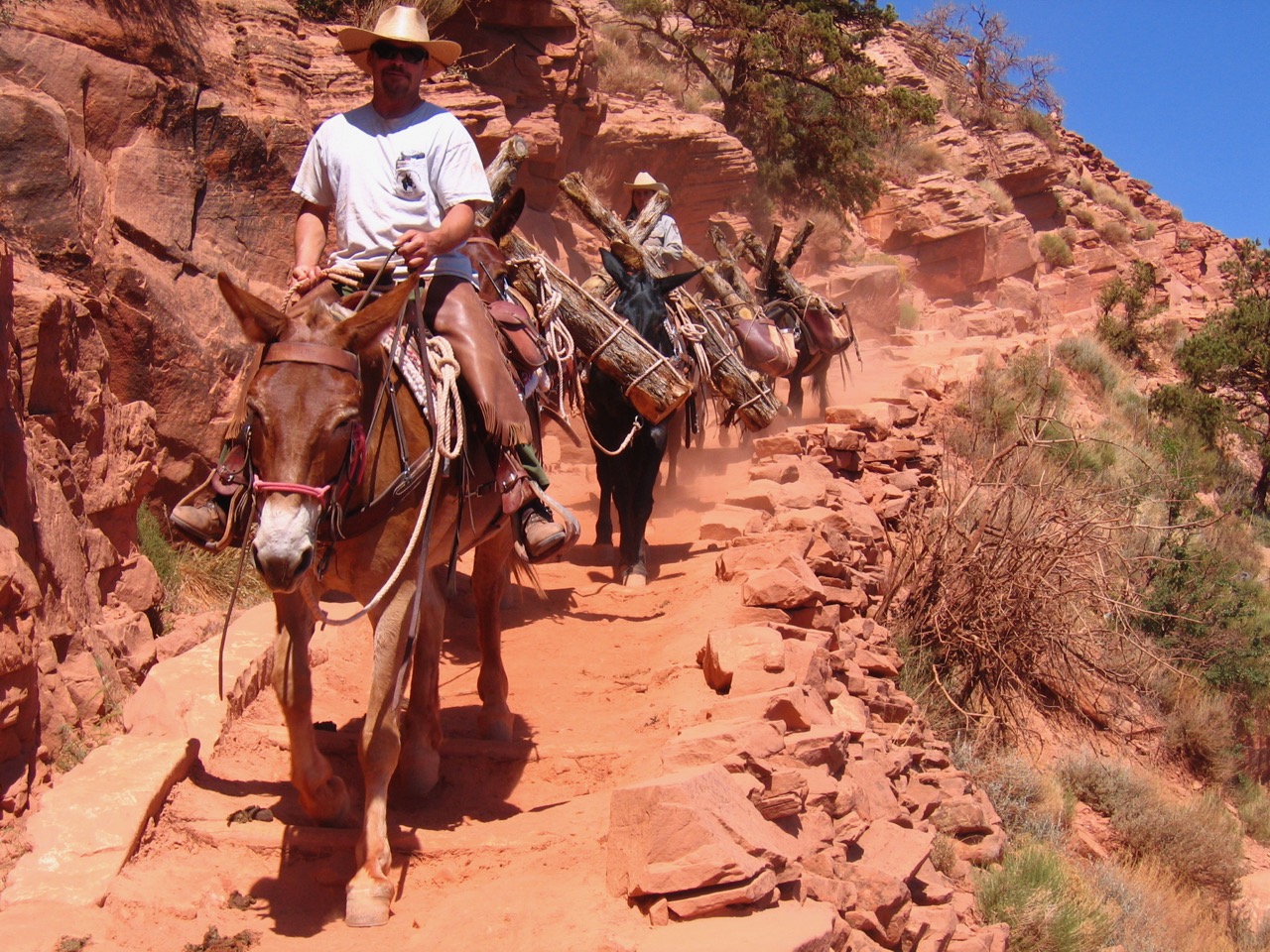
The North Bass Trail, originally known as the Shinumo Trail, was a continuation of the South Bass Trail that William Wallace Bass constructed in the 1890s. Pauites use the term “Shinumo” to refer to the ancient Native American inhabitants whose deteriorating stone structures dot the landscape of the Grand Canyon and many areas along the route through which this trail passes. Once he developed the North Bass Trail from the northern shore of the Colorado River to the North Rim, Bass had completed the first rim-to-rim trail system in the Grand Canyon. As on the South Rim, Bass constructed this trail by improving older trails used by ancient Native Americans and more modern Southern Paiutes. In the 1860s and 1870s parts of the trail had been improved by a prospector named White about whom almost nothing is known. Bass worked on building the trail from 1899-1901 to use in his mining operations and for tourist trips.
When he began constructing the northern branch of his trail, Bass established a tent camp on the north side of the Colorado River along Shinumo Creek. Here he planted an orchard and garden to provide supplies for his family and guests. Modern visitors can see artifacts of the historic Bass camp, including household implements and mining tools, at this site about a mile north of the river.
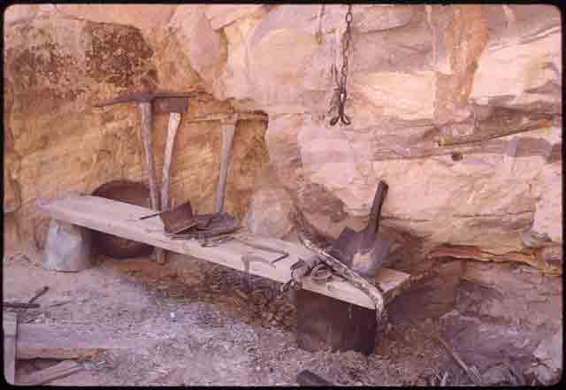
Mining equipment abandoned by Bass can still be seen along Shinumo Creek along the North Bass Trail.
Photo: NAU.PH.2004.8.2.43e4. Margaret Eiseman Collection. Cline Library, Northern Arizona University.
In Bass’s time tourists who used this remote trail would have traveled from the South Rim down the South Bass Trail, crossed the river, and ascended the North Bass Trail to Swamp Point, continuing on to the Kaibab Plateau and Point Sublime about nine miles away. Today, however, most trail users begin on the North Rim at Swamp Point and end at the site of the historic cable tramway river crossing on the north side of the Colorado River. Modern hikers descend nearly a vertical mile from rim to river on the 14-mile North Bass trail.
The modern trail begins in a forest of Ponderosa pine trees that are home to tassel-eared squirrels, which have evolved differently on each rim despite once being part of the same population. On the North Rim they have a black belly and white tail and are known as Kaibab squirrels, while on the South Rim they have a light-colored belly and dark tail, and are known as Abert squirrels. In summer 1989 a fire swept through the upper section of the North Bass Trail, causing many to fear that the forest had been destroyed forever. Several months later, scrub oak, pinyon pine, and manzanita along the upper trail were already putting out new shoots and beginning to regenerate the area.
From Swamp Point, the trail passes by the Powell Plateau, which is slightly higher than the rim, to the deep Muav Saddle below. Early Euro-American explorer John Wesley Powell believed that this area provided the best view of the Grand Canyon, and in 1882 Clarence Dutton named Powell Plateau after him. Archeological evidence shows that Powell Plateau was home to several hundred prehistoric Native Americans despite the fact that there are no permanent springs or streams, a puzzle that archeologists are still trying to solve. Muav Saddle was formed because the underlying Muav Fault weakened the rock, causing accelerated erosion. Here the National Park Service built a structure known as the Muav Saddle Snowshoe Cabin in 1925 when it improved a portion of the trail from Swamp Point to the Powell Plateau. It is the only intact building along the trail.
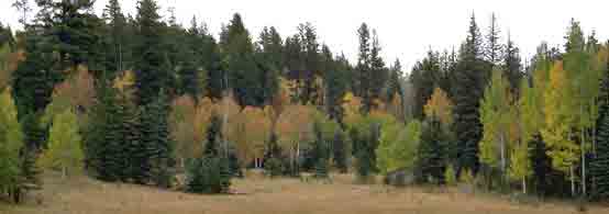
The higher elevation of the North Rim has allowed for the growth of forests filled with pine, fir, and aspen trees.
Photo: National Park Service.
From the Saddle, the trail winds around white Coconino Sandstone cliffs, where water sometimes seeps from under the cross-bedded sandstone, and descends through the Hermit and Supai Group to the bed of Muav Creek, also known as White Creek. The trail follows the creek for about a mile until reaching the top of the Redwall Formation, then curves through the lower Supai Group until reaching a break in the Redwall. Following this break, the trail leads hikers again to White Creek. The canyon is narrow here, with walls of red Muav Limestone and gray Bright Angel Shale on each side complemented by sycamores, cottonwoods, grass, flowers, and maidenhair ferns on the rocks.
In this area is evidence of a prehistoric presence, including several ancient mescal pits. Mescal, also known as agave, is high in sugar content, and some nearby Native American tribes such as the Havasupai and Apache continue to roast them for food today. Following National Park Service rehabilitation of the trail in 2004 and 2005, the trail leaves the creek bed in the Bright Angel Shale, passing through the Tapeats formation and Shinumo Quartzite before intersecting with Shinumo Creek. The trail follows the Creek past Shinumo Camp before continuing overland down to the Colorado River. Along the creek drainage are many ruins of prehistoric pueblos and granaries.
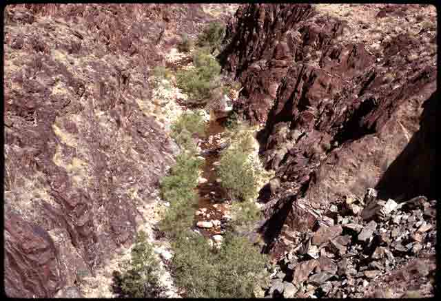
Shinumo Creek offers a welcome glimpse of greenery and water to weary travelers along the North Bass Trail.
Photo: NAU.PH.2004.8.2.43e24. Margaret Eiseman Collection. Cline Library, Northern Arizona University.
Next to Shinumo Creek, Bass built Shinumo Camp as the basis of his operations on the north side of the Colorado River. Bass and several helpers put up tents and a fireplace made of stone. For a table they used a slab of red sandstone on two rock supports. The Bass family planted a garden with melons, cantaloupes, grapes, onion, corn, squash, and beans as well as an orchard. This garden sat on the site of ancient Native American irrigation ditches near the ruins of several cliff dwellings and granaries. The modern trail ends at a site on the broad sandy beach where Bass used to land his ferry. The north cable terminus for Bass’s tramway was located atop schist nearly 60 vertical feet above the river. Today the cable site consists of a flat landing area of stacked stones, cable strands cemented into the schist, and other ruins.
Bass did little work on the North Bass Trail after its original construction except to clear it as needed whenever he passed through. Some tourists continued to use it as part of a trans-canyon trail, and Bass used it to get to locations in side canyons where he prospected on the north side of the Colorado River, but it was never as heavily used as the South Trail. Once other trans-canyon trails were completed in the early 20th Century its usage decreased rapidly and rockslides, floods, and brush reclaimed much of it. The nearly obliterated trail was only kept alive by the efforts of modern wilderness hikers, who left cairns and other markers along its route. The NPS in 2005 located and reconstructed significant portions of the trail to keep it open to backcountry enthusiasts.
Written By Sarah Bohl Gerke
References:
- Anderson, Michael F. Living at the Edge: Explorers, Exploiters and Settlers of the Grand Canyon Region. Grand Canyon Association, 1998.
- Anderson, Michael. Polishing the Jewel: An Administrative History of Grand Canyon National Park. GCA, 2000.
- Babbitt, James, Scott Thybony and George Huey. Grand Canyon Trail Guide: South and North Bass. Grand Canyon Natural History Association, 1996.
- Billingsley, George H., Earle E. Spamer, and Dove Menkes. Quest for the Pillar of Gold: The Mines and Miners of the Grand Canyon. GCA, 1997.
- Hirst, Stephen. Havsuw ‘Baaja: People of the Blue Green Water. Supai: Havasupai Tribal Council, 1985.
- “North Bass Trail.” Grand Canyon National Park. Revised 2008.
- Stampoulos, Linda L. Visiting the Grand Canyon: Views of Early Tourism. Charleston, SC: Arcadia Publishing, 2004.